With
an area of over 492,000 square miles (1,237,000 km2), Ethiopia is the tenth
largest country in Africa (more than twice the size of France). She is bordered
by the Red Sea to the East, the Nile lands to the West, and East Africa to the
South-forming a true crossroads between the East, the Middle East and the rest
of Africa.
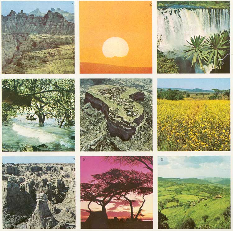
Her dramatic geographic contours, formed a
million years ago, have been hailed by experienced travellers as probably the
most spectacular in the world. They range from mountain peaks to high plateau
to desert lands 350 or more feet below sea level. Her main rivers, |
each hundreds of miles long, are the Blue
Nile, the Awash and the Wabe Shebele. From the highlands of Gojjam Province,
the Blue Nile plunges over the Tisisat or "Smoke of Fire" Falls, at the start
of its 1,000 mile journey to join the White Nile in the Sudan.
The major
portion of the country consists of a high plateau which is responsible for
Ethiopia's climate, unique in Africa, comparable to the best climate anywhere
in the world: months of guaranteed sunshine, yet, thanks to the altitude,
refreshingly mild-with upland temperatures seldom rising above 77 °F (25
°C) nor falling below 45 °F (7 °C). |
Lying near the Equator, Ethiopia's seasons
are reversed: her spring commences in September, and summer runs from January
to the middle of March. The rainy seasons are well defined. The little rains
occur between March and June; mid-June to September is the period of the "big
rains". No rain falls between September and mid-March. |