 |
Kagnew Station |
 |
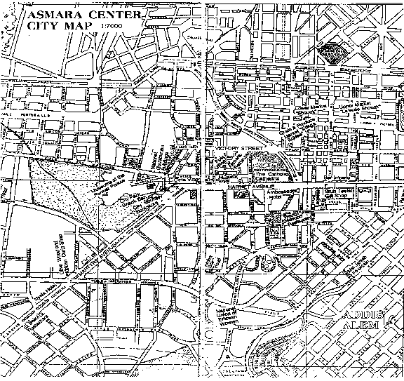
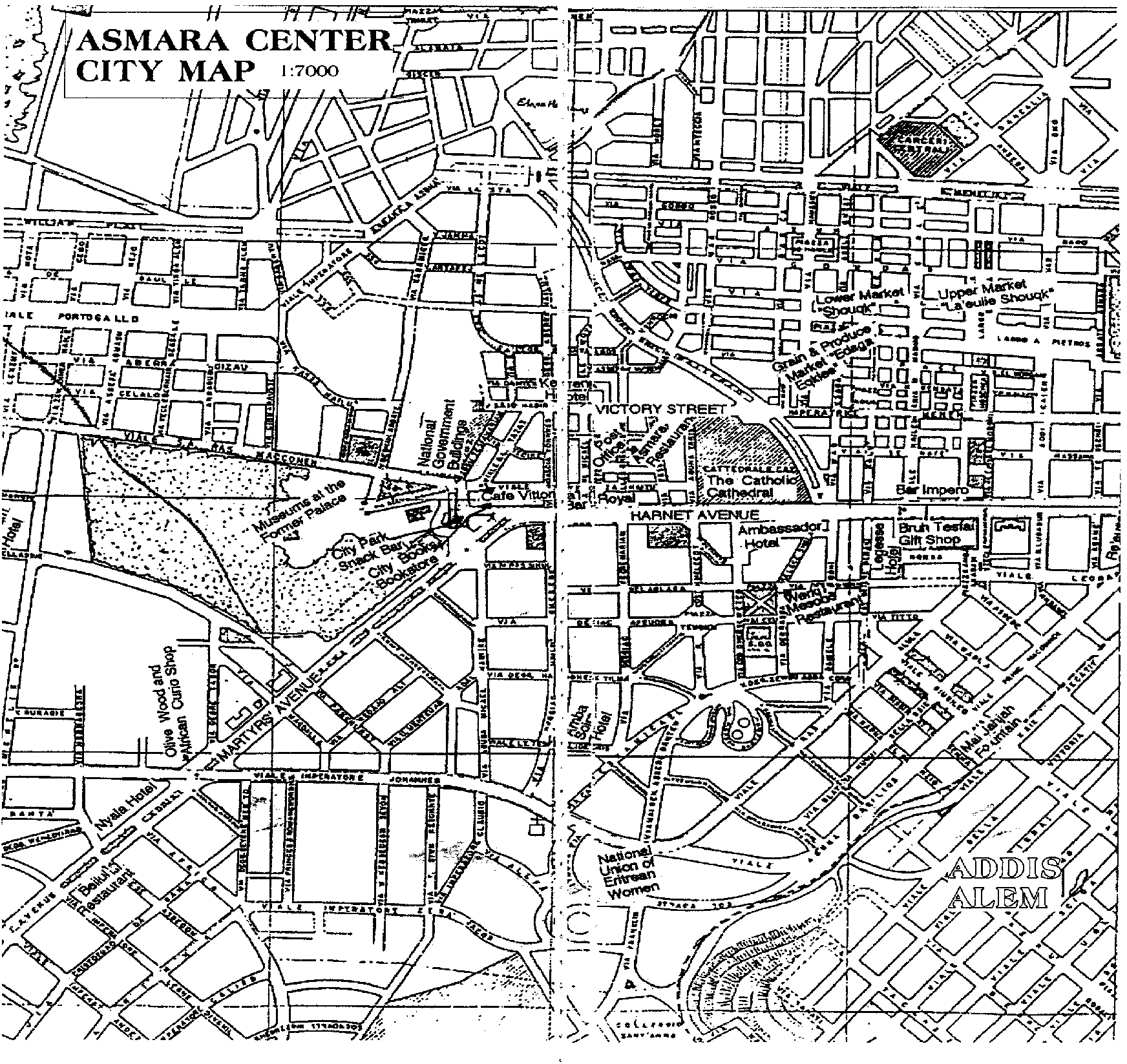
Lee Manchester, 67-69 dependent, sent in a couple of maps he found. The first is a 1938 Italian city map that was revised by the British in 1945. A bit too early for Kagnew, but you can find Radio Marina on it. The second is a nice map call the Historic Perimeter with a legend of buildings and sites. I received this map as a brochure a few years ago from Hans van der Splinter of The Netherlands after one of his trips there. I wasn't sure about posting it, but Lee did all the hard work so I will post it for him. |
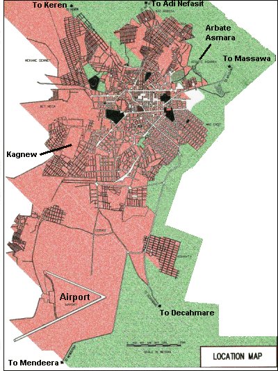
| Asmara map courtesy of Randy Rowley |
| Interesting color-shaded Asmara map. |
| I have recently been in contact with Hans van der Splinter in
The Netherlands and have acquired a new Asmara city map. It is called the
"Asmara City Map & Historic Perimeter" and was printed by Vision Africa for
the Municipality of Asmara & The Cultural Assets Rehabilitation Project in
2003. It was designed by Edward Denison and Guang Yu Ren. It has all the major
buildings and streets noted and I hope to eventually have it posted here. It is
a published and copyrighted piece so I'm trying to contact the organization for
permission. I have also found out that it is available for puchase so I'll get
that information to you soon. For now, here's a sneak peek at the major core of
the city on the map. Asmara City Map & Historic Perimeter |
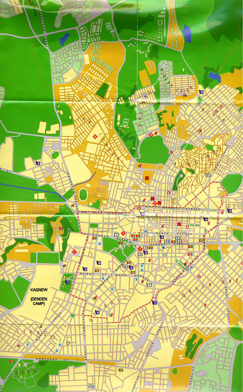
| Asmara city map [Small version] - [Larger version] |